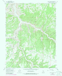
1966 Map of Copper Canyon
USGS Topo · Published 1987About this map
Bitter Creek and its complex network of tributaries carve through the Uintah County landscape in this 1960s topographic record, later updated in the late 1980s. The terrain is defined by massive formations such as McCook Ridge, Indian Ridge, and Park Ridge, which separate a series of deeply inset canyons. Industrial activity in this remote region is evidenced by the presence of a Gas Well and several Drill Holes, signaling the mid-century exploration for natural resources. Transportation is limited to a sparse network of unimproved tracks and a remote Landing Strip, reflecting the isolation of the high desert plateau. Water management and local drainage patterns are visible through features like Reservoir Canyon and Seep Canyon, while colorfully named landmarks such as Suicide Canyon and Death Trap Canyon suggest the formidable nature of the local geography.
Find a feature on this map
20 named features on this map. Tap any name to fly to it.
Don’t see what you’re looking for? This feature index may not catch every label — zoom into the map to look around manually.
Map Details
Editions of this 1966 Copper Canyon Map
2 editions found
Other maps of this area

1885 · East Tavaputs
USGS Topo · 1:250,000

1956 · Grand Junction
USGS Topo · 1:250,000

1959 · Grand Junction
USGS Topo · 1:250,000

1960 · Grand Junction
USGS Topo · 1:250,000

1962 · Grand Junction
USGS Topo · 1:250,000

1964 · Grand Junction
USGS Topo · 1:250,000

1965 · Grand Junction
USGS Topo · 1:250,000

1966 · Seep Canyon
USGS Topo · 1:24,000

1966 · Bates Knolls
USGS Topo · 1:24,000

1966 · Tom Patterson Canyon
USGS Topo · 1:24,000