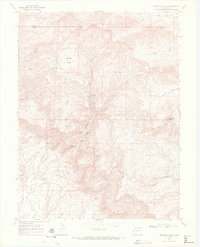
1968 Map of Corcoran Peak
USGS Topo · Published 1972About this map
Hunter Canyon and the surrounding high country of the Colorado plateau define this landscape at the intersection of Garfield and Mesa counties. The late 1960s terrain is heavily marked by the region's extraction history, featuring multiple named mining operations concentrated along the canyon walls, including Hunter Mine, the McGinley Mine, and the Hidden Treasure Mine. To the southwest, the Hi Grade Mine sits below the prominent Ross Ridge.
Find a feature on this map
26 named features on this map. Tap any name to fly to it.
Don’t see what you’re looking for? This feature index may not catch every label — zoom into the map to look around manually.
Map Details
Editions of this 1968 Corcoran Peak Map
2 editions found
Other maps of this area

1929 · Roan Creek
USGS Topo · 1:62,500

1956 · Grand Junction
USGS Topo · 1:250,000

1959 · Grand Junction
USGS Topo · 1:250,000

1960 · Grand Junction
USGS Topo · 1:250,000

1962 · Grand Junction
USGS Topo · 1:250,000

1962 · Fruita
USGS Topo · 1:24,000
1962 · Round Mountain
USGS Topo · 1:24,000

1962 · Corcoran Point
USGS Topo · 1:24,000

1964 · Grand Junction
USGS Topo · 1:250,000

1965 · Grand Junction
USGS Topo · 1:250,000