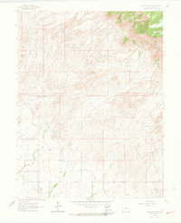
1962 Map of Corcoran Point
USGS Topo · Published 1964About this map
The arid landscape north of Grand Junction is defined by a complex network of drainage washes and irrigation infrastructure during the early 1960s. Central to the region's development are the Government Highline Canal and Grand Valley Canal, which carve through the terrain to support local agriculture. The topography rises sharply toward the prominent landform of Corcoran Point and the distinct profile of Basin Butte to the northwest.
Find a feature on this map
18 named features on this map. Tap any name to fly to it.
Don’t see what you’re looking for? This feature index may not catch every label — zoom into the map to look around manually.
Map Details
Editions of this 1962 Corcoran Point Map
5 editions found

Other maps of this area

1929 · Roan Creek
USGS Topo · 1:62,500

1934 · Colorado National Monument
USGS Topo · 1:24,000

1956 · Grand Junction
USGS Topo · 1:250,000

1959 · Grand Junction
USGS Topo · 1:250,000

1960 · Grand Junction
USGS Topo · 1:250,000

1962 · Grand Junction
USGS Topo · 1:250,000

1962 · Fruita
USGS Topo · 1:24,000

1962 · Clifton
USGS Topo · 1:24,000

1962 · Colorado National Monument
USGS Topo · 1:24,000

1962 · Grand Junction
USGS Topo · 1:24,000