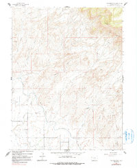
1962 Map of Corcoran Point
USGS Topo · Published 1991About this map
Coal mining operations and complex irrigation networks define this portion of Mesa County during the early 1960s. The landscape is marked by several active or established workings, including the Corcoran Mine, Thomas Mine, and Grosso Mine, which highlight the importance of the local mining industry to the regional economy. Near the southern edge, the Walker Field aviation site serves as a primary transit hub for the Grand Valley, while the Crown Point Cem provides a quiet connection to the area's early settlers.
Find a feature on this map
17 named features on this map. Tap any name to fly to it.
Don’t see what you’re looking for? This feature index may not catch every label — zoom into the map to look around manually.
Map Details
Editions of this 1962 Corcoran Point Map
5 editions found

Other maps of this area

1929 · Roan Creek
USGS Topo · 1:62,500

1934 · Colorado National Monument
USGS Topo · 1:24,000

1956 · Grand Junction
USGS Topo · 1:250,000

1959 · Grand Junction
USGS Topo · 1:250,000

1960 · Grand Junction
USGS Topo · 1:250,000

1962 · Grand Junction
USGS Topo · 1:250,000

1962 · Fruita
USGS Topo · 1:24,000

1962 · Clifton
USGS Topo · 1:24,000

1962 · Colorado National Monument
USGS Topo · 1:24,000

1962 · Grand Junction
USGS Topo · 1:24,000