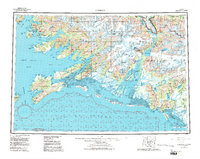
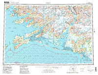
1959 Map of Cordova
USGS Topo · Published 1986About this map
Cordova serves as the focal point for this survey of the eastern Prince William Sound and the expansive Copper River Delta. The landscape reflects a transitional period in Alaskan infrastructure, where the legacy of early 20th-century industry is visible in the Copper River and Northwestern RR Grade, which once connected interior copper mines to the coast. This transit corridor is partially mirrored by the development of the Copper River Highway near Eyak Lake.
Find a feature on this map
63 named features on this map. Tap any name to fly to it.
Don’t see what you’re looking for? This feature index may not catch every label — zoom into the map to look around manually.
Map Details
Editions of this 1959 Cordova Map
6 editions found

Other maps of this area

1946 · Blying Sound
USGS Topo · 1:250,000

1948 · Cordova
USGS Topo · 1:250,000

1948 · Middleton Island
USGS Topo · 1:250,000

1950 · Middleton Island
USGS Topo · 1:250,000

1950 · McCarthy A-8
USGS Topo · 1:63,360

1950 · Bering Glacier
USGS Topo · 1:250,000

1950 · Icy Bay
USGS Topo · 1:250,000

1950 · Valdez A-3
USGS Topo · 1:63,360

1950 · Cordova B-2
USGS Topo · 1:63,360

1950 · Cordova C-7
USGS Topo · 1:63,360