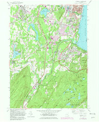
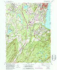
1957 Map of Cornwall
USGS Topo · Published 1981About this map
Stewart Airport and the Stewart Army Sub-Post anchor the northwestern corner of this Hudson Highlands landscape, which transitions from military and aviation infrastructure into the densely settled riverfront of Cornwall-on-the-Hudson. The mid-20th-century landscape is defined by the intersection of industrial engineering and residential growth, seen in the path of the Catskill Aqueduct and the New York State Thruway cutting through the town of New Windsor.
Find a feature on this map
97 named features on this map. Tap any name to fly to it.
Don’t see what you’re looking for? This feature index may not catch every label — zoom into the map to look around manually.
Map Details
Editions of this 1957 Cornwall Map
5 editions found
Other maps of this area

1892 · West Point
USGS Topo · 1:62,500

1893 · Poughkeepsie
USGS Topo · 1:62,500

1894 · West Point
USGS Topo · 1:62,500

1894 · Poughkeepsie
USGS Topo · 1:62,500

1899 · West Point
USGS Topo · 1:62,500

1901 · West Point
USGS Topo · 1:62,500

1902 · Schunemunk
USGS Topo · 1:62,500

1903 · Poughkeepsie
USGS Topo · 1:62,500

1903 · Newburg
USGS Topo · 1:62,500

1930 · Schunemunk
USGS Topo · 1:48,000