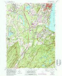
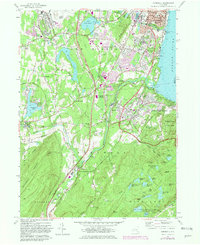
1957 Map of Cornwall
USGS Topo · Published 1987About this map
Stewart Airport and its adjacent Stewart Army Sub-Post dominate the northwestern plateau of this mid-century Orange County landscape. The survey traces the industrial and residential corridors of Newburgh and New Windsor south along the Hudson River, where the Conrail line and the New York State Thruway facilitate the movement of goods and people. Local history is deeply etched into the terrain at sites like the Temple Hill Monument and Knox Headquarters, reflecting the area's significance in early American history.
Find a feature on this map
92 named features on this map. Tap any name to fly to it.
Don’t see what you’re looking for? This feature index may not catch every label — zoom into the map to look around manually.
Map Details
Editions of this 1957 Cornwall Map
5 editions found
Other maps of this area

1892 · West Point
USGS Topo · 1:62,500

1893 · Poughkeepsie
USGS Topo · 1:62,500

1894 · West Point
USGS Topo · 1:62,500

1894 · Poughkeepsie
USGS Topo · 1:62,500

1899 · West Point
USGS Topo · 1:62,500

1901 · West Point
USGS Topo · 1:62,500

1902 · Schunemunk
USGS Topo · 1:62,500

1903 · Poughkeepsie
USGS Topo · 1:62,500

1903 · Newburg
USGS Topo · 1:62,500

1930 · Schunemunk
USGS Topo · 1:48,000