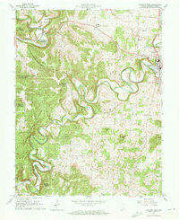
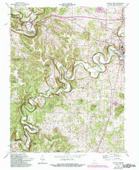
1962 Map of Corydon West
USGS Topo · Published 1964About this map
Indian Creek meanders deeply across this Harrison County landscape, defining the topography between the seat of Corydon and the wooded expanses of the Harrison-Crawford State Forest. In the early 1960s, the area's agricultural and spiritual life is well-documented through numerous rural landmarks, including Heidelberg Ch, Fairview Ch, and several family burial grounds like Trout Cem and Bliss Cem. The northern section is dominated by the Blue River valley near White Cloud, where Scout Mtn rises above the water. Transportation and industry are evidenced by the Louisville New Albany and Corydon railroad line and the Harrison County Airport. Unique geological features, such as the sharp ridge of the Devils Backbone and the massive flow of Harrison Spring, highlight the distinctive karst-influenced terrain of this part of southern Indiana.
Find a feature on this map
42 named features on this map. Tap any name to fly to it.
Don’t see what you’re looking for? This feature index may not catch every label — zoom into the map to look around manually.
Map Details
Editions of this 1962 Corydon West Map
5 editions found
Other maps of this area

1931 · Corydon
USGS Topo · 1:62,500

1944 · Corydon West
USGS Topo · 1:24,000

1946 · Leavenworth
USGS Topo · 1:24,000

1946 · Depauw
USGS Topo · 1:24,000

1947 · Leavenworth
USGS Topo · 1:24,000

1947 · Corydon West
USGS Topo · 1:24,000

1947 · Mauckport
USGS Topo · 1:24,000

1948 · Corydon East
USGS Topo · 1:24,000

1948 · Milltown
USGS Topo · 1:24,000

1948 · Laconia
USGS Topo · 1:24,000