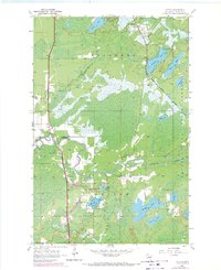
1956 Map of Cotton
USGS Topo · Published 1971About this map
Whiteface River and its tributaries define this pocket of St. Louis County, where the unincorporated settlement of Cotton serves as a local crossroads. Revised in the late 1960s, the map documents a landscape transitioning between marshland and managed timber within the Cloquet Valley State Forest. The transportation corridor is dominated by the Duluth Winnipeg and Pacific railroad, which cuts a diagonal path through the township of Ellsburg toward the northern hamlet of Melrude.
Find a feature on this map
27 named features on this map. Tap any name to fly to it.
Don’t see what you’re looking for? This feature index may not catch every label — zoom into the map to look around manually.
Map Details
Editions of this 1956 Cotton Map
5 editions found
Other maps of this area

1951 · Central Lakes
USGS Topo · 1:24,000

1951 · Zim
USGS Topo · 1:24,000

1951 · Makinen
USGS Topo · 1:24,000

1953 · Canyon
USGS Topo · 1:24,000

1953 · Shaw
USGS Topo · 1:24,000

1953 · Payne
USGS Topo · 1:24,000

1954 · Hibbing
USGS Topo · 1:250,000

1956 · Cotton
USGS Topo · 1:24,000

1956 · Whiteface
USGS Topo · 1:24,000

1957 · Hibbing
USGS Topo · 1:250,000