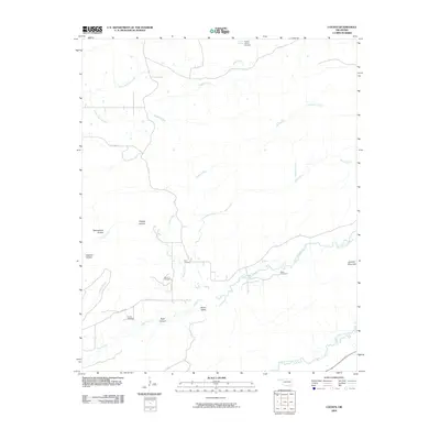
2009 Map of Counts
USGS Topo · Published 2009About this map
Jackfork Mountain anchors the southeastern corner of this Pittsburg County landscape, where the terrain transitions into the broad drainage of Burris Valley. The map reveals a rural pattern of development defined by family-named landmarks and small, scattered burial grounds. Local genealogists will find several notable sites, including the Pulcher Cemetery in the north near Pulcher Spring, as well as the Nace Cemetery, Burris Cemetery, and Smith Cemetery further south.
Find a feature on this map
27 named features on this map. Tap any name to fly to it.
Don’t see what you’re looking for? This feature index may not catch every label — zoom into the map to look around manually.
Map Details
Editions of this 2009 Counts Map
This is the sole edition of this map. No revisions or reprints were ever made.
Other maps of this area

1898 · McAlester
USGS Topo · 1:125,000

1901 · Tuskahoma
USGS Topo · 1:125,000

1908 · Tuskahoma
USGS Topo · 1:125,000

1909 · Mc Alester
USGS Topo · 1:125,000

1909 · Tuskahoma
USGS Topo · 1:125,000

1950 · Mcalester
USGS Topo · 1:250,000

1962 · McAlester
USGS Topo · 1:250,000

1965 · McAlester
USGS Topo · 1:250,000

1967 · Hartshorne SW
USGS Topo · 1:24,000

1967 · Hartshorne
USGS Topo · 1:24,000