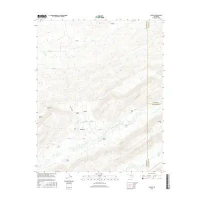
2016 Map of Counts
USGS Topo · Published 2016About this map
Ti Valley and the surrounding high ridges of the Choctaw Nation's historical territory dominate this landscape in southeastern Oklahoma. The map focuses on the small settlements of Counts and Weathers, which are connected by a network of rural routes such as Burris Valley Rd and N418 Rd. The area is notably dense with small family or community burial sites, including the Nace Cem, Smith Cem, and Baker Cem, often located near seasonal watercourses like Hogeye Cr and North Jackfork Creek. The topography is defined by significant elevation changes, from the depths of Rush Canyon and Yellowjacket Hollow to the prominent heights of Jackfork Mtn. This distribution of cemeteries and isolated farm roads reflects a long-standing pattern of dispersed upland settlement in the rugged terrain between Pittsburg and Latimer counties.
Find a feature on this map
39 named features on this map. Tap any name to fly to it.
Don’t see what you’re looking for? This feature index may not catch every label — zoom into the map to look around manually.
Map Details
Editions of this 2016 Counts Map
This is the sole edition of this map. No revisions or reprints were ever made.
Other maps of this area

1898 · McAlester
USGS Topo · 1:125,000

1901 · Tuskahoma
USGS Topo · 1:125,000

1908 · Tuskahoma
USGS Topo · 1:125,000

1909 · Mc Alester
USGS Topo · 1:125,000

1909 · Tuskahoma
USGS Topo · 1:125,000

1950 · Mcalester
USGS Topo · 1:250,000

1962 · McAlester
USGS Topo · 1:250,000

1965 · McAlester
USGS Topo · 1:250,000

1967 · Hartshorne SW
USGS Topo · 1:24,000

1967 · Hartshorne
USGS Topo · 1:24,000