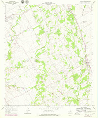
1966 Map of Covington
USGS Topo · Published 1978About this map
Covington and Rio Vista anchor this mid-1960s study of the terrain where the Johnson Co Hill Co boundary divides the north-central Texas landscape. The region is characterized by a network of drainage branches such as Gourd Neck Branch and Darr Branch, which feed into the larger Aquilla Creek and Mustang Creek. This era of the landscape reveals a heavy reliance on local rural infrastructure, evidenced by numerous small family or community burial grounds including Kinard Cem, Parker Cem, and Hart Cem.
Find a feature on this map
25 named features on this map. Tap any name to fly to it.
Don’t see what you’re looking for? This feature index may not catch every label — zoom into the map to look around manually.
Map Details
Editions of this 1966 Covington Map
2 editions found
Other maps of this area

1891 · Cleburne
USGS Topo · 1:125,000

1894 · Cleburne
USGS Topo · 1:125,000

1924 · Cleburne 3-B
USGS Topo · 1:48,000

1924 · Cleburne 3-C
USGS Topo · 1:48,000

1927 · Blum
USGS Topo · 1:62,500

1954 · Dallas
USGS Topo · 1:250,000

1958 · Dallas
USGS Topo · 1:250,000

1960 · Cleburne East
USGS Topo · 1:24,000
1961 · Cleburne West
USGS Topo · 1:24,000
1961 · Grandview
USGS Topo · 1:24,000