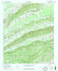
1947 Map of Cox Gap
USGS Topo · Published 1973About this map
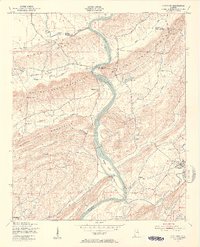
Ashville anchors the western edge of this landscape, where the ridges and valleys of northeast Alabama create a distinct corridor for early settlement and transport. Surveyed in 1947, the map captures a network of rural congregations that defined community life in the mid-century, including Weeping Mary Ch, Gum Springs Ch, and Poplar Springs Ch. The topography is dominated by parallel ridges including the Canoe Creek Mountains, Hines Mountain, and the Beaver Creek Mountains, which forced travel through narrow passages like Looney Gap and Cox Gap.
Find a feature on this map
28 named features on this map. Tap any name to fly to it.
Don’t see what you’re looking for? This feature index may not catch every label — zoom into the map to look around manually.
Map Details
Editions of this 1947 Cox Gap Map
5 editions found
Other maps of this area

1889 · Springville
USGS Topo · 1:125,000

1892 · Springville
USGS Topo · 1:125,000

1947 · Cox Gap
USGS Topo · 1:24,000

1947 · Dunaway Mountain
USGS Topo · 1:24,000

1947 · Ragland
USGS Topo · 1:62,500

1947 · Ragland
USGS Topo · 1:24,000

1947 · Francis Mill
USGS Topo · 1:24,000

1947 · Steele
USGS Topo · 1:24,000

1947 · Steele
USGS Topo · 1:62,500
1949 · Ohatchee
USGS Topo · 1:24,000