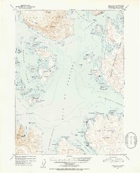
1951 Map of Craig C-5
USGS Topo · Published 1953About this map
The maritime economy of the Alexander Archipelago is centered on the Noyes Island Cannery and the deep-water access provided by Steamboat Bay. This remote region of the Tongass National Forest is defined by a dense network of passages and channels, including the Gulf of Esquibel and San Christoval Channel. Settlement is largely dictated by the shoreline, with specific locations like Bobs Place and the interestingly named Hole in the Wall (Abandoned) on the San Lorenzo Islands marking the rare points of human activity among the steep coastal ridges. The interior of the larger landmasses, such as Heceta Island and Prince of Wales Island, rises sharply to landmarks like Bald Mtn and Timber Knob. This survey captures the navigational landscape of the early 1950s, where small anchorages like Nossuk Anchorage served as vital links for coastal traffic.
Find a feature on this map
84 named features on this map. Tap any name to fly to it.
Don’t see what you’re looking for? This feature index may not catch every label — zoom into the map to look around manually.
Map Details
Editions of this 1951 Craig C-5 Map
5 editions found
Other maps of this area

1948 · Craig B-5
USGS Topo · 1:63,360

1948 · Craig B-6
USGS Topo · 1:63,360

1949 · Craig D-4
USGS Topo · 1:63,360

1949 · Craig C-4
USGS Topo · 1:63,360

1949 · Craig B-4
USGS Topo · 1:63,360

1951 · Craig C-6
USGS Topo · 1:63,360

1951 · Craig D-6
USGS Topo · 1:63,360

1951 · Craig B-4
USGS Topo · 1:63,360

1951 · Craig C-4
USGS Topo · 1:63,360

1951 · Craig C-5
USGS Topo · 1:63,360