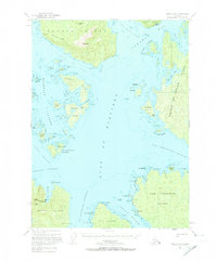
1951 Map of Craig C-5
USGS Topo · Published 1974About this map
Noyes Island and the rugged coastal archipelago of the Alaska Panhandle are defined here by the maritime industry and navigation of the mid-twentieth century. The Gulf of Esquibel serves as the central waterway, separating Heceta Island in the north from San Fernando Island and Lulu Island to the south. The presence of the Noyes Island Cannery and its adjacent Seaplane Base at Steamboat Bay underscores the area's economic reliance on commercial fishing and aviation-based logistics in an era before extensive road development.
Find a feature on this map
76 named features on this map. Tap any name to fly to it.
Don’t see what you’re looking for? This feature index may not catch every label — zoom into the map to look around manually.
Map Details
Editions of this 1951 Craig C-5 Map
5 editions found
Other maps of this area

1948 · Craig B-5
USGS Topo · 1:63,360

1948 · Craig B-6
USGS Topo · 1:63,360

1949 · Craig D-4
USGS Topo · 1:63,360

1949 · Craig C-4
USGS Topo · 1:63,360

1949 · Craig B-4
USGS Topo · 1:63,360

1951 · Craig C-6
USGS Topo · 1:63,360

1951 · Craig D-6
USGS Topo · 1:63,360

1951 · Craig B-4
USGS Topo · 1:63,360

1951 · Craig C-4
USGS Topo · 1:63,360

1951 · Craig C-5
USGS Topo · 1:63,360