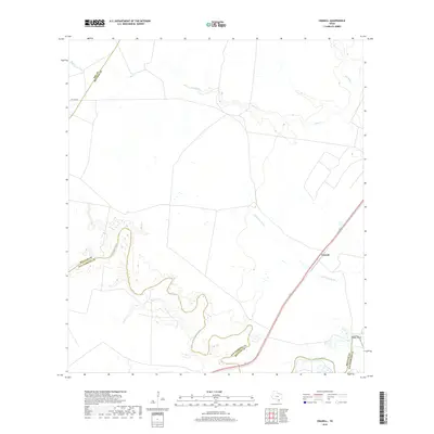
2019 Map of Cranell
USGS Topo · Published 2019About this map
Aransas River meanders deeply across the southern landscape, defining the jagged boundary line between San Patricio and Refugio Counties. The settlement of Cranell sits near the eastern edge of the quadrangle, serving as a primary point of human occupancy in an otherwise wide-open coastal plain. The terrain is marked by intricate drainage patterns, including the intermittent flow of Chocolate Swale and the northern reaches of Sous Cr and Devils Run. Low-lying areas like Rooke Bend suggest the tidal influence and swampy character of the river valley. This survey illustrates the modern road network, including Pvt Rd 6004, providing a clear look at how property lines and rural access roads have evolved in this part of South Texas.
Find a feature on this map
10 named features on this map. Tap any name to fly to it.
Don’t see what you’re looking for? This feature index may not catch every label — zoom into the map to look around manually.
Map Details
Editions of this 2019 Cranell Map
This is the sole edition of this map. No revisions or reprints were ever made.
Other maps of this area

1953 · Beeville
USGS Topo · 1:250,000

1954 · Skidmore
USGS Topo · 1:62,500

1954 · Woodsboro
USGS Topo · 1:62,500

1954 · Sinton
USGS Topo · 1:62,500

1954 · Refugio
USGS Topo · 1:62,500

1956 · Beeville
USGS Topo · 1:250,000

1960 · Beeville
USGS Topo · 1:250,000

1978 · Woodsboro
USGS Topo · 1:24,000

1978 · Cranell
USGS Topo · 1:24,000

1978 · Refugio SW
USGS Topo · 1:24,000