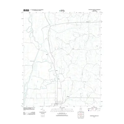
2012 Map of Crenshaw North
USGS Topo · Published 2012About this map
Coldwater River and its intricate drainage network define this pocket of Northwest Mississippi, where the landscape transitions from the delta lowlands to the rolling hills. Small communities and named crossroads such as Strayhorn, Sarah, and Askew are connected by a web of rural routes like Sarah Rd and Browns Ferry Rd. The importance of water management in this alluvial environment is evident in the presence of the Coon Bayou Cut-Off and numerous named drainages including Egypt Cr and Kirksey Cr.
Find a feature on this map
78 named features on this map. Tap any name to fly to it.
Don’t see what you’re looking for? This feature index may not catch every label — zoom into the map to look around manually.
Map Details
Editions of this 2012 Crenshaw North Map
This is the sole edition of this map. No revisions or reprints were ever made.
Other maps of this area

1908 · Hollywood
USGS Topo · 1:24,000

1908 · Walnut Lake
USGS Topo · 1:24,000

1910 · Walnut Lake
USGS Topo · 1:31,680

1913 · Hollywood
USGS Topo · 1:31,680

1932 · Sledge
USGS Topo · 1:48,000

1932 · Marks
USGS Topo · 1:48,000

1932 · Crenshaw
USGS Topo · 1:62,500

1935 · Marks
USGS Topo · 1:62,500

1935 · Crenshaw
USGS Topo · 1:62,500

1935 · Sledge
USGS Topo · 1:62,500