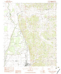
1983 Map of Crenshaw North
USGS Topo · Published 1983About this map
The Illinois Central Gulf railroad serves as the primary north-south artery through this Mississippi Delta landscape, connecting the agricultural communities of Crenshaw, Askew, and Sarah. The terrain is defined by the winding course of the Coldwater River and a complex network of waterways including Coon Bayou and Yellow Lake Bayou. This water-rich environment is punctuated by the Askew Refuge, where the river's meandering path creates a series of loops and low-lying wetlands.
Find a feature on this map
36 named features on this map. Tap any name to fly to it.
Don’t see what you’re looking for? This feature index may not catch every label — zoom into the map to look around manually.
Map Details
Editions of this 1983 Crenshaw North Map
This is the sole edition of this map. No revisions or reprints were ever made.
Other maps of this area

1908 · Hollywood
USGS Topo · 1:24,000

1908 · Walnut Lake
USGS Topo · 1:24,000

1910 · Walnut Lake
USGS Topo · 1:31,680

1913 · Hollywood
USGS Topo · 1:31,680

1932 · Sledge
USGS Topo · 1:48,000

1932 · Marks
USGS Topo · 1:48,000

1932 · Crenshaw
USGS Topo · 1:62,500

1935 · Marks
USGS Topo · 1:62,500

1935 · Crenshaw
USGS Topo · 1:62,500

1935 · Sledge
USGS Topo · 1:62,500