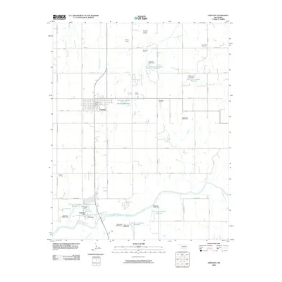
2009 Map of Crescent
USGS Topo · Published 2009About this map
Crescent serves as the central hub of this Logan County landscape, situated amidst a network of energy production and water management. To the north and east, the Northeast Crescent Oil Field and East Lovell Oil Field mark the industrial character of the region, while the town itself preserves local history at the Crescent Post Office. The southern portion of the map is defined by the winding path of the Cimarron River, where smaller residential developments like Cimarron City have taken shape near managed water bodies such as Lake Lattawanna and Cedar Cove Lake. Genealogists will find three distinct burial sites across the township, including Mount Hope Cemetery, Crescent Cemetery, and the more isolated Knowles Cemetery near the western boundary. A series of numbered reservoirs, such as Oknoname 083051 Reservoir, illustrate the modern hydraulic engineering used to manage the drainage of Shawnee Creek and Wolf Creek.
Find a feature on this map
54 named features on this map. Tap any name to fly to it.
Don’t see what you’re looking for? This feature index may not catch every label — zoom into the map to look around manually.
Map Details
Editions of this 2009 Crescent Map
This is the sole edition of this map. No revisions or reprints were ever made.
Other maps of this area

1892 · Guthrie
USGS Topo · 1:62,500

1892 · Kingfisher
USGS Topo · 1:125,000

1893 · Mulhall
USGS Topo · 1:62,500

1893 · Lovell
USGS Topo · 1:62,500

1895 · Kingfisher
USGS Topo · 1:125,000

1954 · Oklahoma City
USGS Topo · 1:250,000

1955 · Enid
USGS Topo · 1:250,000

1957 · Oklahoma City
USGS Topo · 1:250,000

1958 · Enid
USGS Topo · 1:250,000

1963 · Oklahoma City
USGS Topo · 1:250,000