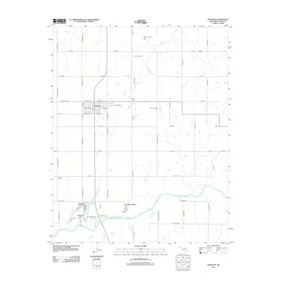
2012 Map of Crescent
USGS Topo · Published 2012About this map
The town of Crescent serves as the focal point of this Logan County survey, situated just north of the meandering Cimarron River. The local economy is defined by energy extraction, with the Northeast Crescent Oil Field and East Lovell Oil Field dominating the northern landscape. This 2012 snapshot shows a mix of established residential patterns and newer developments such as Cimarron City and Crescent Springs near the riverbanks. Family history and genealogy researchers will find several well-marked burial grounds, including Mt Hope Cem, Knowles Cem, and the Crescent Cem. The area is also characterized by water features like Lake Lattawanna and Cedar Cove Lake, which contrast with the grid-iron road system that sections the plains into agricultural and industrial parcels. Significant local infrastructure is also documented, notably the Sky High Airport east of the main town site.
Find a feature on this map
63 named features on this map. Tap any name to fly to it.
Don’t see what you’re looking for? This feature index may not catch every label — zoom into the map to look around manually.
Map Details
Editions of this 2012 Crescent Map
This is the sole edition of this map. No revisions or reprints were ever made.
Other maps of this area

1892 · Guthrie
USGS Topo · 1:62,500

1892 · Kingfisher
USGS Topo · 1:125,000

1893 · Mulhall
USGS Topo · 1:62,500

1893 · Lovell
USGS Topo · 1:62,500

1895 · Kingfisher
USGS Topo · 1:125,000

1954 · Oklahoma City
USGS Topo · 1:250,000

1955 · Enid
USGS Topo · 1:250,000

1957 · Oklahoma City
USGS Topo · 1:250,000

1958 · Enid
USGS Topo · 1:250,000

1963 · Oklahoma City
USGS Topo · 1:250,000