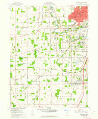
1961 Map of Cridersville
USGS Topo · Published 1963About this map
The southern industrial and suburban expansion of Lima dominates the landscape of this 1961 survey, where the Lima Ordnance Modification Center stands as a significant military and industrial landmark. The transition from the urban density of the city's southern edge to the townships of Amanda, Shawnee, and Duchouquet reveals a mid-century infrastructure of specialized facilities, including the Ottawa Valley Hospital and a large Tank Farm. Moving south into Auglaize County, the settlement of Cridersville serves as a secondary hub along the Baltimore and Ohio railroad line.
Find a feature on this map
54 named features on this map. Tap any name to fly to it.
Don’t see what you’re looking for? This feature index may not catch every label — zoom into the map to look around manually.
Map Details
Editions of this 1961 Cridersville Map
3 editions found
Other maps of this area

1906 · Lima
USGS Topo · 1:62,500

1906 · Columbus Grove
USGS Topo · 1:62,500

1908 · Columbus Grove
USGS Topo · 1:62,500

1911 · Spencerville
USGS Topo · 1:62,500

1911 · Delphos
USGS Topo · 1:62,500

1944 · Delphos
USGS Topo · 1:62,500

1944 · Spencerville
USGS Topo · 1:62,500

1953 · Muncie
USGS Topo · 1:250,000

1956 · Muncie
USGS Topo · 1:250,000
1960 · Delphos
USGS Topo · 1:24,000