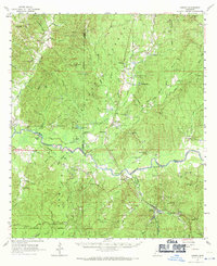
1961 Map of Crosby
USGS Topo · Published 1971About this map
The Homochitto River winds through the heart of the Homochitto National Forest in this 1961 survey, defining the border between several southwest Mississippi counties. The landscape is a dense network of creek drainages like Sandy Creek and Turkey Creek, punctuated by industrial activity from the Illinois Central railroad. Remote settlements such as Knoxville and Garden City are visible alongside specialized infrastructure like the Leesdale Lookout Tower and a Gaging Station on the river.
Find a feature on this map
105 named features on this map. Tap any name to fly to it.
Don’t see what you’re looking for? This feature index may not catch every label — zoom into the map to look around manually.
Map Details
Editions of this 1961 Crosby Map
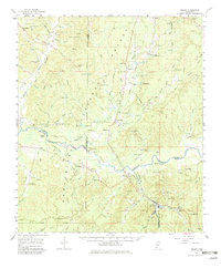
3 editions found

Other maps of this area

1921 · Natchez
USGS Topo · 1:48,000

1922 · Natchez
USGS Topo · 1:62,500

1936 · Woodville
USGS Topo · 1:62,500

1939 · Natchez
USGS Topo · 1:62,500

1939 · Kingston
USGS Topo · 1:62,500

1953 · Natchez
USGS Topo · 1:250,000

1956 · Natchez
USGS Topo · 1:250,000

1958 · Woodville
USGS Topo · 1:62,500

1958 · Kingston
USGS Topo · 1:62,500

1959 · Natchez
USGS Topo · 1:250,000