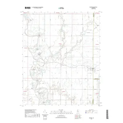
2018 Map of Crowder
USGS Topo · Published 2018About this map
Crowder sits at the junction of the Old Yocona River and the Little Tallahatchie River, serving as a focal point for this wetland-dominated landscape on the border of Panola and Quitman counties. The terrain is defined by an intricate network of abandoned river bends and hydraulic engineering, most notably the numerous "cut-offs" such as the Marks Cut-Off, Wright School Cut-Off, and Morning Star Cut-Off. These features suggest a history of active floodplain management and river channel migration, common in the Mississippi Delta region.
Find a feature on this map
87 named features on this map. Tap any name to fly to it.
Don’t see what you’re looking for? This feature index may not catch every label — zoom into the map to look around manually.
Map Details
Editions of this 2018 Crowder Map
This is the sole edition of this map. No revisions or reprints were ever made.
Other maps of this area

1932 · Sledge
USGS Topo · 1:48,000

1932 · Tutwiler
USGS Topo · 1:48,000

1932 · Marks
USGS Topo · 1:48,000

1935 · Crowder
USGS Topo · 1:62,500

1935 · Marks
USGS Topo · 1:62,500

1935 · Tutwiler
USGS Topo · 1:62,500

1935 · Sledge
USGS Topo · 1:62,500

1939 · Sledge
USGS Topo · 1:62,500

1939 · Crowder
USGS Topo · 1:62,500

1939 · Tutwiler
USGS Topo · 1:62,500