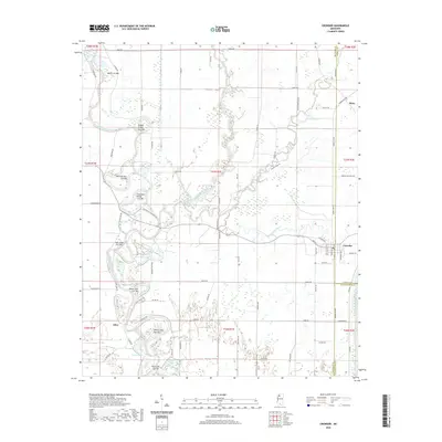
2020 Map of Crowder
USGS Topo · Published 2020About this map
The confluence of river systems and man-made alterations defines this portion of the Mississippi Delta, where the Tallahatchie River and Old Yocona River meet. The landscape is characterized by a complex network of hydrological features, including numerous oxbows and cut-offs that speak to the region's history of water management and land reclamation. Notable among these are Marks Cut-Off, Morning Star Cut-Off, and Willow Lake Cut-Off, which represent systematic efforts to straighten the winding delta waterways.
Find a feature on this map
86 named features on this map. Tap any name to fly to it.
Don’t see what you’re looking for? This feature index may not catch every label — zoom into the map to look around manually.
Map Details
Editions of this 2020 Crowder Map
This is the sole edition of this map. No revisions or reprints were ever made.
Other maps of this area

1932 · Sledge
USGS Topo · 1:48,000

1932 · Tutwiler
USGS Topo · 1:48,000

1932 · Marks
USGS Topo · 1:48,000

1935 · Crowder
USGS Topo · 1:62,500

1935 · Marks
USGS Topo · 1:62,500

1935 · Tutwiler
USGS Topo · 1:62,500

1935 · Sledge
USGS Topo · 1:62,500

1939 · Sledge
USGS Topo · 1:62,500

1939 · Crowder
USGS Topo · 1:62,500

1939 · Tutwiler
USGS Topo · 1:62,500