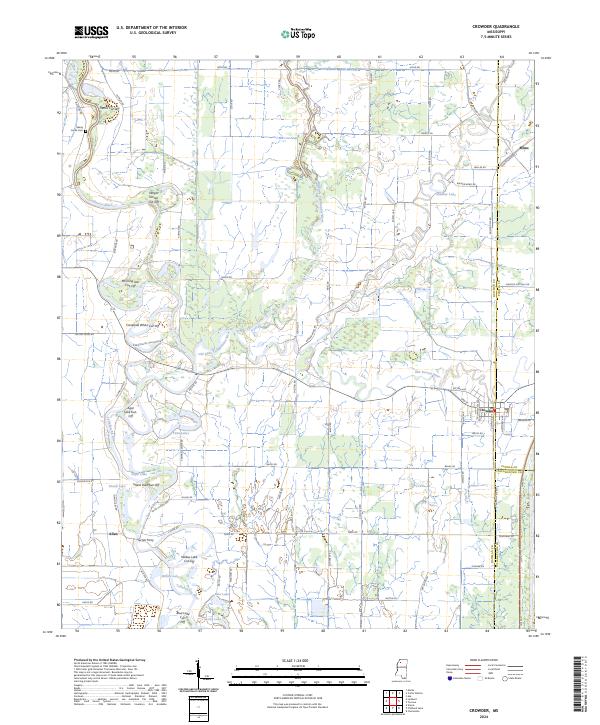
2024 Map of Crowder
USGS Topo · Published 2024About this map
The Coldwater River and Tallahatchie River converge in this delta landscape, where complex hydraulic engineering is visible through numerous man-made bypasses. The town of Crowder sits at a junction of county lines, bordered by the Coldwater River National Wildlife Refuge. The map reveals a history of flood control and agricultural land management, evidenced by features such as the Marks Cut-Off, Morning Star Cut-Off, and Campbell White Cut-Off. These alterations to the natural flow of the Old Little Tallahatchie River and Old Yocona River demonstrate how the region has been reshaped for drainage. Local heritage is marked by small settlements like Mims and Allen, alongside family-named landmarks such as Turner Ferry and the Shady Grove Cem, which anchor the rural road network in this river-bottom territory.
Find a feature on this map
89 named features on this map. Tap any name to fly to it.
Don’t see what you’re looking for? This feature index may not catch every label — zoom into the map to look around manually.
Map Details
Editions of this 2024 Crowder Map
This is the sole edition of this map. No revisions or reprints were ever made.
Other maps of this area

1932 · Sledge
USGS Topo · 1:48,000

1932 · Tutwiler
USGS Topo · 1:48,000

1932 · Marks
USGS Topo · 1:48,000

1935 · Crowder
USGS Topo · 1:62,500

1935 · Marks
USGS Topo · 1:62,500

1935 · Tutwiler
USGS Topo · 1:62,500

1935 · Sledge
USGS Topo · 1:62,500

1939 · Sledge
USGS Topo · 1:62,500

1939 · Crowder
USGS Topo · 1:62,500

1939 · Tutwiler
USGS Topo · 1:62,500