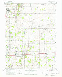
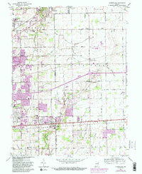
1962 Map of Cumberland
USGS Topo · Published 1964About this map
The Fort Benjamin Harrison Mil Res and its associated Billings VA Hospital anchor the northwestern corner of this landscape as it appeared in the early 1960s. The geography is defined by the transition from suburban development near Cumberland and Oaklandon to the fertile agricultural lands of Buck Creek and Sugar Creek townships. This era of mid-century growth is evident in the expanding residential grids of Warren and Billings, while older rural institutions like the Amity Ch and Wesley Chapel Cem persist in the eastern sections.
Find a feature on this map
81 named features on this map. Tap any name to fly to it.
Don’t see what you’re looking for? This feature index may not catch every label — zoom into the map to look around manually.
Map Details
Editions of this 1962 Cumberland Map
5 editions found
Other maps of this area

1948 · Indianapolis East
USGS Topo · 1:24,000

1948 · Beech Grove
USGS Topo · 1:24,000

1952 · Cumberland
USGS Topo · 1:24,000

1952 · Greenfield
USGS Topo · 1:24,000

1952 · Fountaintown
USGS Topo · 1:24,000

1952 · Fishers
USGS Topo · 1:24,000

1952 · Ingalls
USGS Topo · 1:24,000

1952 · Mc Cordsville
USGS Topo · 1:24,000

1953 · Acton
USGS Topo · 1:24,000

1953 · Cincinnati
USGS Topo · 1:250,000