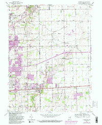
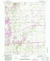
1962 Map of Cumberland
USGS Topo · Published 1988About this map
Cumberland stands at the intersection of the National Road and the county line during a period of suburban expansion into the Indiana countryside. The map documents the eastern edges of Indianapolis as it meets the agricultural lands of Marion and Hancock Counties, where grid-patterned streets like East 10th Street and East 21st Street push into established farmlands. Large institutional footprints define the landscape, including the southern portion of Fort Benjamin Harrison Mil Res, the Sunnyside Sanitarium, and the sprawling Washington Park Cemetery East.
Find a feature on this map
83 named features on this map. Tap any name to fly to it.
Don’t see what you’re looking for? This feature index may not catch every label — zoom into the map to look around manually.
Map Details
Editions of this 1962 Cumberland Map
5 editions found
Other maps of this area

1948 · Indianapolis East
USGS Topo · 1:24,000

1948 · Beech Grove
USGS Topo · 1:24,000

1952 · Cumberland
USGS Topo · 1:24,000

1952 · Greenfield
USGS Topo · 1:24,000

1952 · Fountaintown
USGS Topo · 1:24,000

1952 · Fishers
USGS Topo · 1:24,000

1952 · Ingalls
USGS Topo · 1:24,000

1952 · Mc Cordsville
USGS Topo · 1:24,000

1953 · Acton
USGS Topo · 1:24,000

1953 · Cincinnati
USGS Topo · 1:250,000