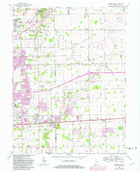
1962 Map of Cumberland
USGS Topo · Published 1982About this map
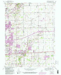
Cumberland stands as a focal point along the historic National Road, marking the border between Marion and Hancock counties during a period of suburban expansion into the Indiana countryside. The landscape is a dense network of family-named cemeteries and rural institutions, such as the Sunnyside Sanatorium and Billings VA Hospital near the Fort Benjamin Harrison Mil Res boundary. This transition from farmland to residential development is evident in the cluster of small family burial grounds like Witte Cem, Langenberger Cem, and Snider Cem that persist alongside newer infrastructure like the Mount Comfort Airport. The drainage patterns of Buck Creek and its many tributaries, including Doe Creek and Muesing Cr, define the terrain of Warren and Sugar Creek townships, while the Conrail line provides a continuous industrial link across the central plains.
Find a feature on this map
95 named features on this map. Tap any name to fly to it.
Don’t see what you’re looking for? This feature index may not catch every label — zoom into the map to look around manually.
Map Details
Editions of this 1962 Cumberland Map
5 editions found
Other maps of this area

1948 · Indianapolis East
USGS Topo · 1:24,000

1948 · Beech Grove
USGS Topo · 1:24,000

1952 · Cumberland
USGS Topo · 1:24,000

1952 · Greenfield
USGS Topo · 1:24,000

1952 · Fountaintown
USGS Topo · 1:24,000

1952 · Fishers
USGS Topo · 1:24,000

1952 · Ingalls
USGS Topo · 1:24,000

1952 · Mc Cordsville
USGS Topo · 1:24,000

1953 · Acton
USGS Topo · 1:24,000

1953 · Cincinnati
USGS Topo · 1:250,000