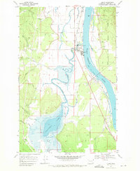
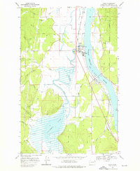
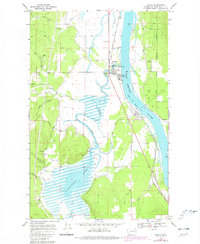
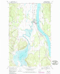
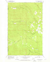
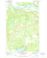
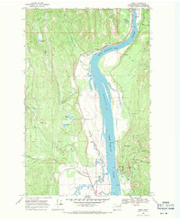
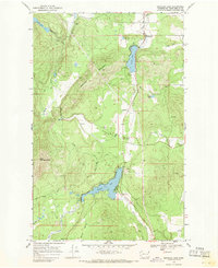
1968 Map of Cusick
USGS Topo · Published 1971About this map
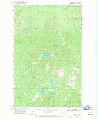
The Pend Oreille River flows northward through this late 1960s landscape, serving as the primary geographic axis for the riverfront towns of Cusick and Usk. This area of Pend Oreille County is defined by the winding course of Calispell Creek, which meanders through a broad valley before emptying into the main river near the County Fairgrounds. To the south, Calispell Lake dominates the lowlands, surrounded by terrain marked for controlled inundation, illustrating the managed water levels essential to this valley's geography.
Find a feature on this map
29 named features on this map. Tap any name to fly to it.
Don’t see what you’re looking for? This feature index may not catch every label — zoom into the map to look around manually.
Map Details
Editions of this 1968 Cusick Map
4 editions found
Other maps of this area

1936 · Newport
USGS Topo · 1:96,000

1942 · Newport
USGS Topo · 1:125,000

1958 · Sandpoint
USGS Topo · 1:250,000

1963 · Sandpoint
USGS Topo · 1:250,000
1968 · Cusick
USGS Topo · 1:24,000
1968 · Winchester Peak
USGS Topo · 1:24,000
1968 · Diamond Lake
USGS Topo · 1:24,000
1968 · Jared
USGS Topo · 1:24,000
1968 · Sacheen Lake
USGS Topo · 1:24,000
1968 · Browns Lake
USGS Topo · 1:24,000