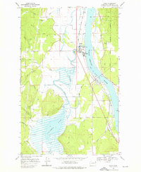
1968 Map of Cusick
USGS Topo · Published 1976About this map
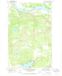
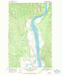
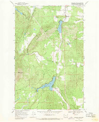
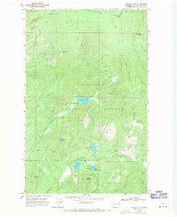
Cusick and Usk serve as the primary hubs of activity along the Pend Oreille River during the late 1960s. This survey highlights a landscape where indigenous heritage and civic development meet, centered around the Kalispel Indian Reservation and the Indian Community Hall. The river valley is a complex network of wetlands and tributaries, dominated by the expansive Calispell Lake and the winding course of Calispell Creek. Local industry and infrastructure are evident in the Chicago Milwaukee St Paul and Pacific railroad line, which hugs the western bank of the river near the County Fairgrounds. Farther west, the terrain rises toward the Flowery Trail, revealing a more secluded landscape of mountain forks and timbered slopes, including the headwaters of Trimble Creek and Winchester Creek.
Find a feature on this map
25 named features on this map. Tap any name to fly to it.
Don’t see what you’re looking for? This feature index may not catch every label — zoom into the map to look around manually.
Map Details
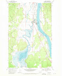
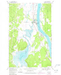
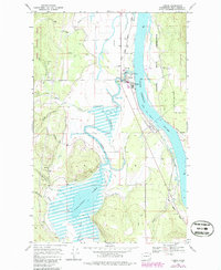
Editions of this 1968 Cusick Map
4 editions found
Other maps of this area

1936 · Newport
USGS Topo · 1:96,000

1942 · Newport
USGS Topo · 1:125,000

1958 · Sandpoint
USGS Topo · 1:250,000

1963 · Sandpoint
USGS Topo · 1:250,000
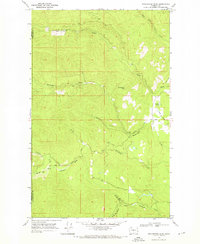
1968 · Cusick
USGS Topo · 1:24,000
1968 · Winchester Peak
USGS Topo · 1:24,000
1968 · Diamond Lake
USGS Topo · 1:24,000
1968 · Jared
USGS Topo · 1:24,000
1968 · Sacheen Lake
USGS Topo · 1:24,000
1968 · Browns Lake
USGS Topo · 1:24,000