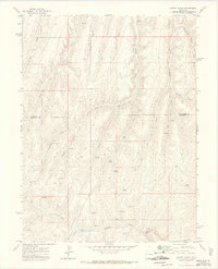
1971 Map of Cutoff Gulch
USGS Topo · Published 1974About this map
Parachute Creek carves through the high plateau country of western Colorado, where this early 1970s survey documents a landscape defined by drainage systems and mineral exploration. The boundary between Rio Blanco Co and Garfield Co runs east-to-west across the center of the terrain, crossing numerous steep drainages such as Cutoff Gulch and Stewart Fork. Resource extraction is evident through several marked Prospects and a specific Mine located along the upper reaches of the Fork. The area is sparsely developed, primarily accessible via a network of Jeep Trails that connect vital water sources like Bragg Spring and Barnes Spring. Notable landmarks such as Davis Point and Porcupine Gulch offer clear reference points for understanding the topographical complexity of this portion of the Piceance Basin before modern large-scale energy development moved into the region.
Find a feature on this map
25 named features on this map. Tap any name to fly to it.
Don’t see what you’re looking for? This feature index may not catch every label — zoom into the map to look around manually.
Map Details
Editions of this 1971 Cutoff Gulch Map
3 editions found
Other maps of this area

1925 · Parachute Creek
USGS Topo · 1:62,500

1927 · Parachute Creek
USGS Topo · 1:62,500

1929 · Highmore
USGS Topo · 1:62,500

1952 · Rock School
USGS Topo · 1:24,000

1952 · Jessup Gulch
USGS Topo · 1:24,000

1952 · No Name Ridge
USGS Topo · 1:24,000

1956 · Grand Junction
USGS Topo · 1:250,000

1959 · Grand Junction
USGS Topo · 1:250,000

1960 · Grand Junction
USGS Topo · 1:250,000

1962 · Grand Junction
USGS Topo · 1:250,000