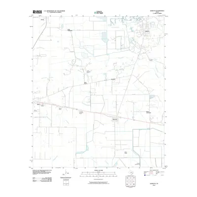
2010 Map of Daisetta
USGS Topo · Published 2010About this map
Daisetta and its surrounding coastal plain settlements are depicted here in a landscape defined by meandering bayous and a dense network of local roads. The area shows a distinct pattern of small, clustered communities such as Frige Settlement, Moore Settlement, and Rock Island, which are interspersed between larger towns like Hardin and Raywood. This spatial arrangement reflects a long-standing agricultural and residential layout where water bodies like Turtle Bayou and Cow Island Bayou served as natural boundaries and drainage for the low-lying terrain.
Find a feature on this map
54 named features on this map. Tap any name to fly to it.
Don’t see what you’re looking for? This feature index may not catch every label — zoom into the map to look around manually.
Map Details
Editions of this 2010 Daisetta Map
This is the sole edition of this map. No revisions or reprints were ever made.
Other maps of this area

1943 · Whites Bayou
USGS Topo · 1:24,000

1943 · Liberty
USGS Topo · 1:125,000

1950 · Houston
USGS Topo · 1:250,000

1954 · Beaumont
USGS Topo · 1:250,000

1955 · Daisetta
USGS Topo · 1:62,500

1955 · Liberty
USGS Topo · 1:62,500

1956 · Houston
USGS Topo · 1:250,000

1957 · Beaumont
USGS Topo · 1:250,000

1961 · Shiloh
USGS Topo · 1:24,000
1961 · Whites Bayou
USGS Topo · 1:24,000