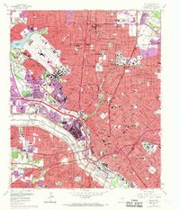
1958 Map of Dallas
USGS Topo · Published 1969About this map
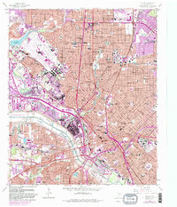
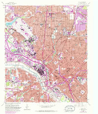
Love Field Municipal Airport and the expansive Dallas Floodway dominate the western landscape of this mid-century survey. The urban core of Dallas is shown in transition, with massive infrastructure projects like the Stemmons Expressway and Thornton Freeway beginning to carve through established neighborhoods. Education and civic pride are evident in the dense concentration of schools, from Crozier Technical High Sch to the campus of Southern Methodist University. In the southeast, the grounds of Fair Park and the Cotton Bowl stand as prominent landmarks of Texas culture. This map records the city’s post-war expansion and the complex rail network of the St Louis Southwestern RR and Texas and Pacific RR before the full dominance of the interstate system. Cultural anchors like Oakland Cemetery and the Theological Seminary provide critical touchpoints for local family history research.
Find a feature on this map
71 named features on this map. Tap any name to fly to it.
Don’t see what you’re looking for? This feature index may not catch every label — zoom into the map to look around manually.
Map Details
Editions of this 1958 Dallas Map
7 editions found
Other maps of this area

1891 · Dallas
USGS Topo · 1:125,000

1893 · Dallas
USGS Topo · 1:125,000

1925 · Dallas 2-b
USGS Topo · 1:48,000

1931 · Carrollton
USGS Topo · 1:62,500

1954 · Dallas
USGS Topo · 1:250,000

1957 · White Rock Lake
USGS Topo · 1:24,000

1958 · Dallas
USGS Topo · 1:250,000

1958 · Hutchins
USGS Topo · 1:24,000

1958 · Oak Cliff
USGS Topo · 1:24,000

1958 · Dallas
USGS Topo · 1:24,000