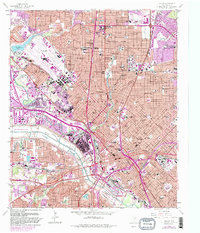
1958 Map of Dallas
USGS Topo · Published 1986About this map
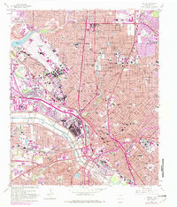
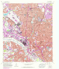
Dallas and its neighboring enclaves of University Park and Highland Park are depicted here during a period of massive post-war expansion. The landscape is defined by its complex transportation infrastructure, from the early flight operations at Dallas Love Airfield to the burgeoning network of the Stemmons Expressway and Central Expressway. Institutional anchors like Southern Methodist University and the Theological Seminary stand alongside recreational landmarks such as the Cotton Bowl within Fair Park. The map also captures the critical engineering of the Dallas Floodway along the Trinity River, which sought to manage the city's water flow. Cultural and educational history is deeply visible through numerous neighborhood landmarks, including Cochran Chapel, Crozier Technical High School, and the Pilot Institute for the Deaf.
Find a feature on this map
87 named features on this map. Tap any name to fly to it.
Don’t see what you’re looking for? This feature index may not catch every label — zoom into the map to look around manually.
Map Details
Editions of this 1958 Dallas Map
7 editions found
Other maps of this area

1891 · Dallas
USGS Topo · 1:125,000

1893 · Dallas
USGS Topo · 1:125,000

1925 · Dallas 2-b
USGS Topo · 1:48,000

1931 · Carrollton
USGS Topo · 1:62,500

1954 · Dallas
USGS Topo · 1:250,000

1957 · White Rock Lake
USGS Topo · 1:24,000

1958 · Dallas
USGS Topo · 1:250,000

1958 · Hutchins
USGS Topo · 1:24,000

1958 · Oak Cliff
USGS Topo · 1:24,000

1958 · Dallas
USGS Topo · 1:24,000