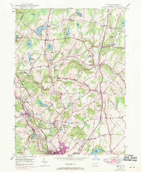
1946 Map of Dalton
USGS Topo · Published 1971About this map
Dalton and the surrounding townships of North Abington and South Abington anchor this mid-century look at the Pennsylvania landscape. The region is defined by a dense network of water bodies and small rural junctions, including Lake Kewanee, Lilly Lake, and Glenburn Pond. Traces of local community life are evident in the numerous family and community burial grounds such as Scranton Cem, Miller Cem, and Hickory Grove Cem.
Find a feature on this map
76 named features on this map. Tap any name to fly to it.
Don’t see what you’re looking for? This feature index may not catch every label — zoom into the map to look around manually.
Map Details
Editions of this 1946 Dalton Map
5 editions found
Other maps of this area

1889 · Scranton
USGS Topo · 1:62,500

1891 · Scranton
USGS Topo · 1:62,500

1892 · Dundaff
USGS Topo · 1:62,500

1893 · Pittston
USGS Topo · 1:62,500

1893 · Scranton
USGS Topo · 1:62,500

1943 · Scranton
USGS Topo · 1:125,000

1946 · Tunkhannock
USGS Topo · 1:62,500

1946 · Dalton
USGS Topo · 1:24,000

1946 · Olyphant
USGS Topo · 1:24,000

1946 · Ransom
USGS Topo · 1:24,000
Featured Places
- Scott Township, PA
- Glenburn Township, PA
- Dalton, PA
- La Plume Township, PA
- Carpenter Town, Benton Township