
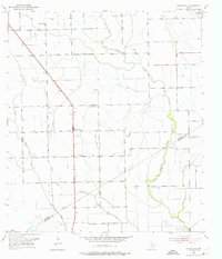
1951 Map of Danevang
USGS Topo · Published 1953About this map
Danevang serves as the central hub of this agricultural and industrial coastal prairie landscape in the early 1950s. The settlement pattern reflects a deeply rooted community, centered around landmarks like the Danevang Sch and Danevang Ch. The surrounding terrain is defined by its drainage and reclamation history, with numerous spoil banks and levees lining the meandering course of Tres Palacios Creek.
Find a feature on this map
13 named features on this map. Tap any name to fly to it.
Don’t see what you’re looking for? This feature index may not catch every label — zoom into the map to look around manually.
Map Details
Editions of this 1951 Danevang Map
2 editions found
Other maps of this area

1952 · Lane City SE
USGS Topo · 1:24,000

1952 · Markham
USGS Topo · 1:24,000

1952 · Francitas NE
USGS Topo · 1:24,000

1952 · Lane City
USGS Topo · 1:24,000

1952 · Midfield
USGS Topo · 1:24,000

1952 · Pierce
USGS Topo · 1:24,000

1953 · Beeville
USGS Topo · 1:250,000

1953 · Seguin
USGS Topo · 1:250,000

1956 · Beeville
USGS Topo · 1:250,000

1958 · Seguin
USGS Topo · 1:250,000