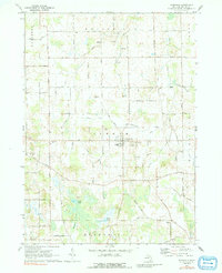
1970 Map of Dansville
USGS Topo · Published 1991About this map
Dansville serves as the central hub for this Ingham County landscape, appearing as a compact village surrounded by a complex network of agricultural drainage and family-named roads. The terrain is defined by the headwaters of several drainages, including Deer Creek, Doan Creek, and Batteese Creek, which navigate through a patchwork of marshlands and small basins. Significant water bodies like Hewes Lake and Ewers Lake sit in the southern half of the map, while the northern sections reveal the area's geological utility through numerous Gravel Pits.
Find a feature on this map
58 named features on this map. Tap any name to fly to it.
Don’t see what you’re looking for? This feature index may not catch every label — zoom into the map to look around manually.
Map Details
Editions of this 1970 Dansville Map
3 editions found
Other maps of this area

1908 · Fowlerville
USGS Topo · 1:62,500

1909 · Mason
USGS Topo · 1:62,500

1910 · Fowlerville
USGS Topo · 1:62,500

1911 · Mason
USGS Topo · 1:62,500

1919 · Stockbridge
USGS Topo · 1:62,500

1919 · Rives Junction
USGS Topo · 1:62,500

1921 · Rives Junction
USGS Topo · 1:62,500

1922 · Stockbridge
USGS Topo · 1:62,500

1942 · Stockbridge
USGS Topo · 1:62,500

1958 · Grand Rapids
USGS Topo · 1:250,000