Loading...
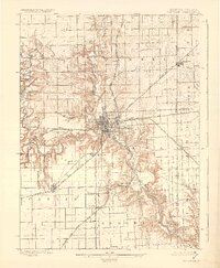
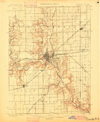
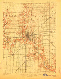
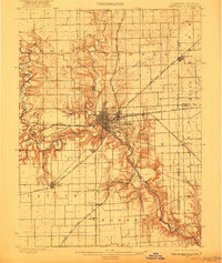
Loading map...1900 Map of Danville
USGS Topo · Published 1930About this map
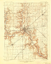
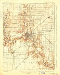
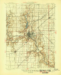
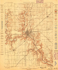
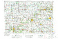
The Vermilion River and its major tributaries, such as the Salt Fork and Stony Creek, carve deep, dendritic drainage patterns through the landscape of east-central Illinois and western Indiana. During this era of industrial expansion, Danville serves as a massive railroad junction where lines like the Wabash R. R. and the Chicago and Eastern Illinois R.R. converge. The intricate rail network supports numerous mining and industrial outposts, including Hillery, Batestown, and Kellyville.
Find a feature on this map
37 named features on this map. Tap any name to fly to it.
Don’t see what you’re looking for? This feature index may not catch every label — zoom into the map to look around manually.
Map Details
Date Portrayed1900
Date Published1930
PublisherU.S. Geological Survey
Map TypeTopographic
Scale1:62,500
Physical Dimensions16.47 x 20 inches
Editions of this 1900 Danville Map
7 editions found
Historical Maps of Danville Through Time
7 maps found


Featured Locations
Source Details
SourceU.S. Geological Survey
CopyrightPublic Domain