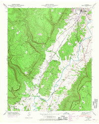
1946 Map of Daus
USGS Topo · Published 1968About this map
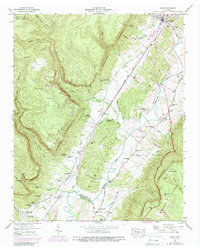
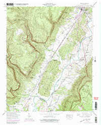
The Cumberland Escarpment dominates this portion of the Sequatchie Valley, where mid-century transportation and small-town settlements follow the level ground between the plateau and Walden Ridge. The Louisville and Nashville railroad runs parallel to the Alvin C York Highway, connecting the communities of Dunlap, Daus, and Cartwright. This post-war landscape is deeply marked by local family and community history, evidenced by numerous small burial grounds such as Pickett Cem and Hudson Cem, alongside rural social centers like Thans Chapel and Center Point Sch. The transition from the high Cumberland Plateau into the valley is carved by numerous gulfs and hollows, including Woodcock Gulf and Mosley Gulf, which feed into the meandering Sequatchie River. Of particular interest to local researchers is the concentration of springs and caves, such as Cookston Cave and Stone Cave Spring, which defined early settlement patterns in this part of Sequatchie Co and Marion Co.
Find a feature on this map
54 named features on this map. Tap any name to fly to it.
Don’t see what you’re looking for? This feature index may not catch every label — zoom into the map to look around manually.
Map Details
Editions of this 1946 Daus Map
6 editions found
Other maps of this area

1888 · Chattanooga
USGS Topo · 1:125,000

1893 · Chattanooga
USGS Topo · 1:125,000

1895 · Sewanee
USGS Topo · 1:125,000

1935 · Mount Airy
USGS Topo · 1:24,000

1936 · Palmer
USGS Topo · 1:24,000

1936 · Daus
USGS Topo · 1:24,000

1936 · Henson Gap
USGS Topo · 1:24,000

1936 · Whitwell
USGS Topo · 1:24,000

1936 · Ketner Gap
USGS Topo · 1:24,000

1936 · Fairmount
USGS Topo · 1:24,000