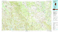
1984 Map of De Kalb
USGS Topo · Published 1990About this map
The Tennessee-Tombigbee Waterway defines the eastern edge of this landscape, a significant engineering feat that parallels the Tombigbee River along the Mississippi and Alabama border. Centered on De Kalb, the seat of Kemper County, the map reveals a region defined by its waterway and rail networks, including the Illinois Central Gulf Railroad corridor passing through Scooba and Shuqualak. The presence of the Meridian Naval Air Station and a separate Naval Auxiliary Air Station near Scooba highlights the strategic military aviation footprint in the mid-1980s.
Find a feature on this map
64 named features on this map. Tap any name to fly to it.
Don’t see what you’re looking for? This feature index may not catch every label — zoom into the map to look around manually.
Map Details
Editions of this 1984 De Kalb Map
2 editions found
Other maps of this area

1921 · Meridian
USGS Topo · 1:48,000

1923 · Meridian
USGS Topo · 1:62,500

1927 · Eutaw
USGS Topo · 1:48,000

1929 · Epes
USGS Topo · 1:48,000

1931 · Eutaw
USGS Topo · 1:62,500

1932 · Epes
USGS Topo · 1:62,500

1947 · Forkland
USGS Topo · 1:24,000

1948 · Mc Dowell
USGS Topo · 1:24,000

1949 · Mc Dowell
USGS Topo · 1:24,000

1949 · Forkland
USGS Topo · 1:24,000