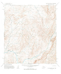
1955 Map of De Long Mountains B-4
USGS Topo · Published 1984About this map
The Kukpuk River winds through this Arctic landscape, creating a dominant drainage system that shapes the local topography. Mapped from 1950s aerial photography by the U.S. Army Topographic Command, the terrain is defined by dramatic elevation changes and sharp landforms such as Spiny Ridge. This mid-century survey captures a corner of the De Long Mountains before modern development, showing a wilderness area devoid of established roads or trails. The intricate contour work illustrates the complex watershed where smaller unnamed tributaries feed into the primary river channel, offering a technical look at the geological makeup of this remote Alaskan region during the early Cold War era of Arctic mapping.
Find a feature on this map
2 named features on this map. Tap any name to fly to it.
Don’t see what you’re looking for? This feature index may not catch every label — zoom into the map to look around manually.
Map Details
Editions of this 1955 De Long Mountains B-4 Map
2 editions found
Other maps of this area

1951 · De Long Mountains
USGS Topo · 1:250,000

1955 · De Long Mountains
USGS Topo · 1:250,000

1955 · De Long Mountains A-3
USGS Topo · 1:63,360

1955 · De Long Mountains A-4
USGS Topo · 1:63,360
1955 · De Long Mountains A-5
USGS Topo · 1:63,360

1955 · De Long Mountains C-4
USGS Topo · 1:63,360

1955 · De Long Mountains C-5
USGS Topo · 1:63,360

1955 · De Long Mountains B-3
USGS Topo · 1:63,360
1955 · De Long Mountains B-5
USGS Topo · 1:63,360
1955 · De Long Mountains B-4
USGS Topo · 1:63,360