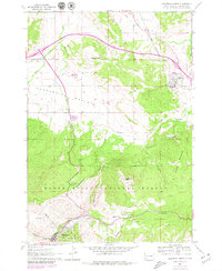
1961 Map of Deadwood North
USGS Topo · Published 1979About this map
Black Hills National Forest land dominates the southern half of this landscape, where steep drainages like Slaughterhouse Gulch and Spruce Gulch carve the terrain around Deadwood. This survey, originally field-checked in the early 1960s with late 1970s revisions, reveals the intersection of gold-rush history and mountain topography. Notable landmarks honoring the area's frontier past include the Preacher Smith Monument and the Seth Bullock Grave near the Mt Moriah Cem and White Rocks. To the north, the terrain softens into the Centennial Prairie, where the Chicago and North Western railway skirts Elkhorn Peak to serve the communities of Whitewood and Crook City. The map captures a transition from the industrial and funerary sites clustered in the gulches to the agricultural expansion and early tourism developments, such as the Campground and Trailer Park facilities appearing near the forest boundary.
Find a feature on this map
35 named features on this map. Tap any name to fly to it.
Don’t see what you’re looking for? This feature index may not catch every label — zoom into the map to look around manually.
Map Details
Editions of this 1961 Deadwood North Map
4 editions found
Other maps of this area

1894 · Deadwood
USGS Topo · 1:125,000

1899 · Sturgis
USGS Topo · 1:62,500

1900 · Spearfish
USGS Topo · 1:62,500

1901 · Deadwood
USGS Topo · 1:125,000

1905 · Saint Onge
USGS Topo · 1:62,500

1907 · Belle Fourche
USGS Topo · 1:125,000

1907 · Redwater
USGS Topo · 1:62,500

1915 · Spearfish
USGS Topo · 1:62,500

1915 · Sturgis
USGS Topo · 1:62,500

1916 · Deadwood
USGS Topo · 1:125,000