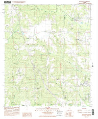
1984 Map of Deatsville
USGS Topo · Published 1985About this map
Deatsville and its surrounding rural landscapes are captured here during a period of transition in central Alabama, where the Autauga and Elmore County line divides the terrain. The community of Pine Level serves as a local hub, supported by a network of rural institutions like Pine Level Ch and Holland Ch. The presence of the Seaboard railroad corridor and the Frank Lee Corr Youth Center indicates the area's evolving infrastructure, while the landscape remains deeply defined by its watercourses, including Mortar Creek and Kenner Creek. Local genealogy and family history are preserved in numerous burial grounds such as McKeithen Cem and the County Line Ch Cem, highlighting the established family networks that have long inhabited this portion of the coastal plain.
Find a feature on this map
40 named features on this map. Tap any name to fly to it.
Don’t see what you’re looking for? This feature index may not catch every label — zoom into the map to look around manually.
Map Details
Editions of this 1984 Deatsville Map
2 editions found
Other maps of this area

1891 · Clanton
USGS Topo · 1:125,000

1901 · Wetumpka
USGS Topo · 1:125,000

1903 · Wetumpka
USGS Topo · 1:125,000

1927 · Montgomery
USGS Topo · 1:48,000

1930 · Montgomery
USGS Topo · 1:62,500

1953 · Montgomery
USGS Topo · 1:250,000

1956 · Montgomery
USGS Topo · 1:250,000

1957 · Montgomery
USGS Topo · 1:250,000

1957 · Autaugaville
USGS Topo · 1:62,500

1958 · Montgomery
USGS Topo · 1:62,500