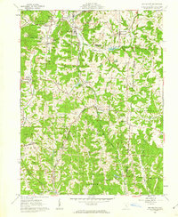
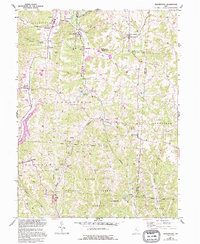
1961 Map of Deavertown
USGS Topo · Published 1962About this map
Wayne National Forest and Harrison State Forest dominate this early 1960s landscape, where small coal-era settlements and family-named landmarks are scattered among the steep ridges of the Black Fork and Moxahala Creek valleys. The map documents a transition in land use, showing numerous Strip Mines alongside rural institutions like Bearfield Sch and Iliff Ch. Industrial footprints are visible in the rail infrastructure, with the Pennsylvania Railroad and New York Central Railroad threading through the terrain to serve mining hamlets such as Misco, Sayre, and the now-quiet San Toy. Genealogists will find significant value in the documentation of numerous local burials, including McLuney Cem, Mocassin Cem, and Bearfield Cem, which mark the settlement history of townships like Bearfield and Wayne.
Find a feature on this map
54 named features on this map. Tap any name to fly to it.
Don’t see what you’re looking for? This feature index may not catch every label — zoom into the map to look around manually.
Map Details
Editions of this 1961 Deavertown Map
6 editions found

Other maps of this area

1910 · Philo
USGS Topo · 1:62,500

1910 · Zanesville
USGS Topo · 1:62,500

1910 · Mc Connelsville
USGS Topo · 1:62,500

1911 · New Lexington
USGS Topo · 1:62,500

1947 · Columbus
USGS Topo · 1:250,000

1949 · Clarksburg
USGS Topo · 1:250,000

1956 · Clarksburg
USGS Topo · 1:250,000

1961 · Columbus
USGS Topo · 1:250,000

1961 · Clarksburg
USGS Topo · 1:250,000

1961 · Corning
USGS Topo · 1:24,000