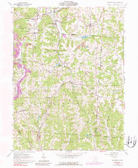
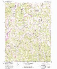
1961 Map of Deavertown
USGS Topo · Published 1989About this map
Extensive Wayne National Forest land dominates the southern half of this area, revealing a landscape defined by its rugged topography and industrial history. The 1961 data highlights the significant impact of the coal industry, with numerous strip mines and oil wells scattered across the drainage basins of the Black Fork and Moxahala Creek. Settled communities like Deavertown and Portersville anchor the high ground, while smaller hamlets such as Rose Farm and San Toy are linked by the Conrail line and winding valley roads. Genealogists will find a wealth of local markers, including the McCaslin Cem and Bearfield Sch. The inclusion of the Crooksville Reservoir and smaller water bodies like Altiers Lake illustrates the local water management essential for both the forest and the surrounding industrial operations.
Find a feature on this map
52 named features on this map. Tap any name to fly to it.
Don’t see what you’re looking for? This feature index may not catch every label — zoom into the map to look around manually.
Map Details
Editions of this 1961 Deavertown Map
6 editions found

Other maps of this area

1910 · Philo
USGS Topo · 1:62,500

1910 · Zanesville
USGS Topo · 1:62,500

1910 · Mc Connelsville
USGS Topo · 1:62,500

1911 · New Lexington
USGS Topo · 1:62,500

1947 · Columbus
USGS Topo · 1:250,000

1949 · Clarksburg
USGS Topo · 1:250,000

1956 · Clarksburg
USGS Topo · 1:250,000

1961 · Columbus
USGS Topo · 1:250,000

1961 · Clarksburg
USGS Topo · 1:250,000

1961 · Corning
USGS Topo · 1:24,000