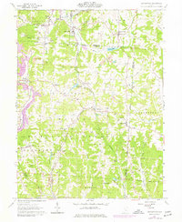
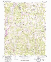
1961 Map of Deavertown
USGS Topo · Published 1977About this map
Wayne National Forest land dominates the lower half of this region, where the rugged topography of Perry and Morgan Counties is marked by deep valleys and coal extraction. The industrial character of the early 1960s is evident in the numerous Strip Mine and Strip Mines operations that carve the hillsides near McLuney and Rose Farm. A network of abandoned and active rail lines once served these mining communities, connecting small settlements like Misco, Sayre, and Tropic.
Find a feature on this map
53 named features on this map. Tap any name to fly to it.
Don’t see what you’re looking for? This feature index may not catch every label — zoom into the map to look around manually.
Map Details
Editions of this 1961 Deavertown Map
6 editions found

Other maps of this area

1910 · Philo
USGS Topo · 1:62,500

1910 · Zanesville
USGS Topo · 1:62,500

1910 · Mc Connelsville
USGS Topo · 1:62,500

1911 · New Lexington
USGS Topo · 1:62,500

1947 · Columbus
USGS Topo · 1:250,000

1949 · Clarksburg
USGS Topo · 1:250,000

1956 · Clarksburg
USGS Topo · 1:250,000

1961 · Columbus
USGS Topo · 1:250,000

1961 · Clarksburg
USGS Topo · 1:250,000

1961 · Corning
USGS Topo · 1:24,000