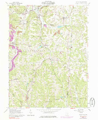
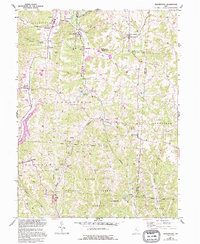
1961 Map of Deavertown
USGS Topo · Published 1984About this map
The Wayne National Forest landscape across southeastern Ohio reveals a pattern of ridge-top settlements and valley-bound industry. The coal mining legacy of the region is evident in the Strip Mine operations and the Conrail rail lines that once served the heavy extraction needs of the early twentieth century. Small, dispersed communities such as Deavertown, San Toy, and Rose Farm are connected by winding roads that follow the high ground, while the drainage of Moxahala Creek and Sunday Creek carves deep into the terrain. Local social history is rooted in landmarks like the Bearfield Sch and Pleasant Grove Ch, reflecting the close-knit rural population of the period. This map also details various water features crucial to the local geography, including the Crooksville Reservoir and Altiers Lake, which alongside numerous family cemeteries like Heff Cem, provide essential landmarks for genealogical research.
Find a feature on this map
54 named features on this map. Tap any name to fly to it.
Don’t see what you’re looking for? This feature index may not catch every label — zoom into the map to look around manually.
Map Details
Editions of this 1961 Deavertown Map
6 editions found

Other maps of this area

1910 · Philo
USGS Topo · 1:62,500

1910 · Zanesville
USGS Topo · 1:62,500

1910 · Mc Connelsville
USGS Topo · 1:62,500

1911 · New Lexington
USGS Topo · 1:62,500

1947 · Columbus
USGS Topo · 1:250,000

1949 · Clarksburg
USGS Topo · 1:250,000

1956 · Clarksburg
USGS Topo · 1:250,000

1961 · Columbus
USGS Topo · 1:250,000

1961 · Clarksburg
USGS Topo · 1:250,000

1961 · Corning
USGS Topo · 1:24,000