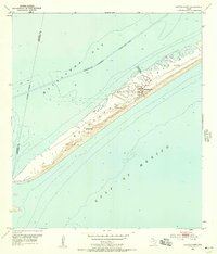
1952 Map of Decros Point
USGS Topo · Published 1957About this map
Matagorda Peninsula stretches as a narrow barrier between the Gulf of Mexico and Matagorda Bay, providing a vital buffer for the Texas coast in the early 1950s. This survey highlights the secluded Matagorda Club complex at the southwestern end of the peninsula, accessible via the Matagorda Club Airport and its accompanying Clubhouse. The landscape is characterized by its isolation, with several sites marked as Flowing Well scattered along the dunes, likely serving the local ranching or club operations. Nautical infrastructure is prominent, including the Intracoastal Waterway and the tip of the land at Decros Point, which marks the entrance to the bay. The map also records the Calhoun and Matagorda county line as an indefinite boundary crossing the marshy terrain.
Find a feature on this map
14 named features on this map. Tap any name to fly to it.
Don’t see what you’re looking for? This feature index may not catch every label — zoom into the map to look around manually.
Map Details
Editions of this 1952 Decros Point Map
3 editions found
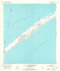
Other maps of this area

1951 · Keller Bay
USGS Topo · 1:24,000

1952 · Palacios Point
USGS Topo · 1:24,000

1952 · Pass Cavallo SW
USGS Topo · 1:24,000

1952 · South of Palacios Point
USGS Topo · 1:24,000

1952 · Decros Point
USGS Topo · 1:24,000

1952 · Port O'Connor
USGS Topo · 1:24,000

1953 · Beeville
USGS Topo · 1:250,000

1956 · Beeville
USGS Topo · 1:250,000

1960 · Beeville
USGS Topo · 1:250,000
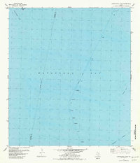
1980 · Carancahua Pass
USGS Topo · 1:24,000