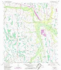
1953 Map of Deer Park
USGS Topo · Published 1986About this map
Deer Park serves as a primary point of interest in this Osceola County landscape, which is defined by an intricate network of waterways and wetlands. The drainage pattern is led by Crabgrass Creek and Bull Creek, with smaller tributaries like Tracy Branch and Yoke Branch feeding into the low-lying terrain. The presence of a Lookout Tower near the settlement and a Gaging Sta along Jane Green Creek indicates the importance of environmental monitoring and fire surveillance in this rural Florida corridor during the mid-20th century.
Find a feature on this map
12 named features on this map. Tap any name to fly to it.
Don’t see what you’re looking for? This feature index may not catch every label — zoom into the map to look around manually.
Map Details
Editions of this 1953 Deer Park Map
5 editions found
Other maps of this area

1953 · Deer Park NE
USGS Topo · 1:24,000

1953 · Holopaw SE
USGS Topo · 1:24,000

1953 · Deer Park SE
USGS Topo · 1:24,000

1953 · Kenansville
USGS Topo · 1:24,000

1953 · Deer Park NW
USGS Topo · 1:24,000

1953 · Kenansville NE
USGS Topo · 1:24,000

1953 · Deer Park
USGS Topo · 1:24,000

1953 · Holopaw
USGS Topo · 1:24,000

1953 · Lake Marian NE
USGS Topo · 1:24,000

1955 · Orlando
USGS Topo · 1:250,000