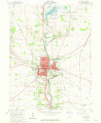
1960 Map of Delaware
USGS Topo · Published 1970About this map
The OlentangY River serves as the central artery for this mid-century portrait of Central Ohio, flowing south from the Delaware Reservoir through the heart of Delaware. The landscape reveals a significant academic and scientific presence, anchored by the Ohio Wesleyan University campus and the prominent Perkins Observatory to the south. Transportation history is deeply etched into the terrain via several prominent railroad corridors, including the Pennsylvania Railroad Grade and the Central Ohio Railroad Grade, which intersect near the city's core.
Find a feature on this map
56 named features on this map. Tap any name to fly to it.
Don’t see what you’re looking for? This feature index may not catch every label — zoom into the map to look around manually.
Map Details
Editions of this 1960 Delaware Map
3 editions found
Other maps of this area

1901 · Dublin
USGS Topo · 1:62,500

1902 · Westerville
USGS Topo · 1:62,500

1903 · Dublin
USGS Topo · 1:62,500

1904 · Westerville
USGS Topo · 1:62,500

1915 · Marengo
USGS Topo · 1:62,500

1924 · Delaware
USGS Topo · 1:62,500

1925 · Delaware
USGS Topo · 1:62,500

1943 · Marengo
USGS Topo · 1:62,500

1944 · Delaware
USGS Topo · 1:62,500

1950 · Marion
USGS Topo · 1:250,000